Threshold pulls raw sighting data from every credible source we can find, runs each report through autonomous AI investigators, and hands you the results with full sourcing. You decide what it means.
🧠
VALKYRIE Investigation Engine
Each sighting gets checked against weather records, satellite passes, ISS tracks, Starlink trains, military flight corridors, nearby bases, meteor databases, and 15 other data sources. Autonomously. Around the clock.
🛡
AEGIS Quality Assurance
A second AI agent audits every investigation for unsupported claims. If VALKYRIE says "satellite confirmed," AEGIS checks whether that satellite was actually overhead. No hallucinations make it through.
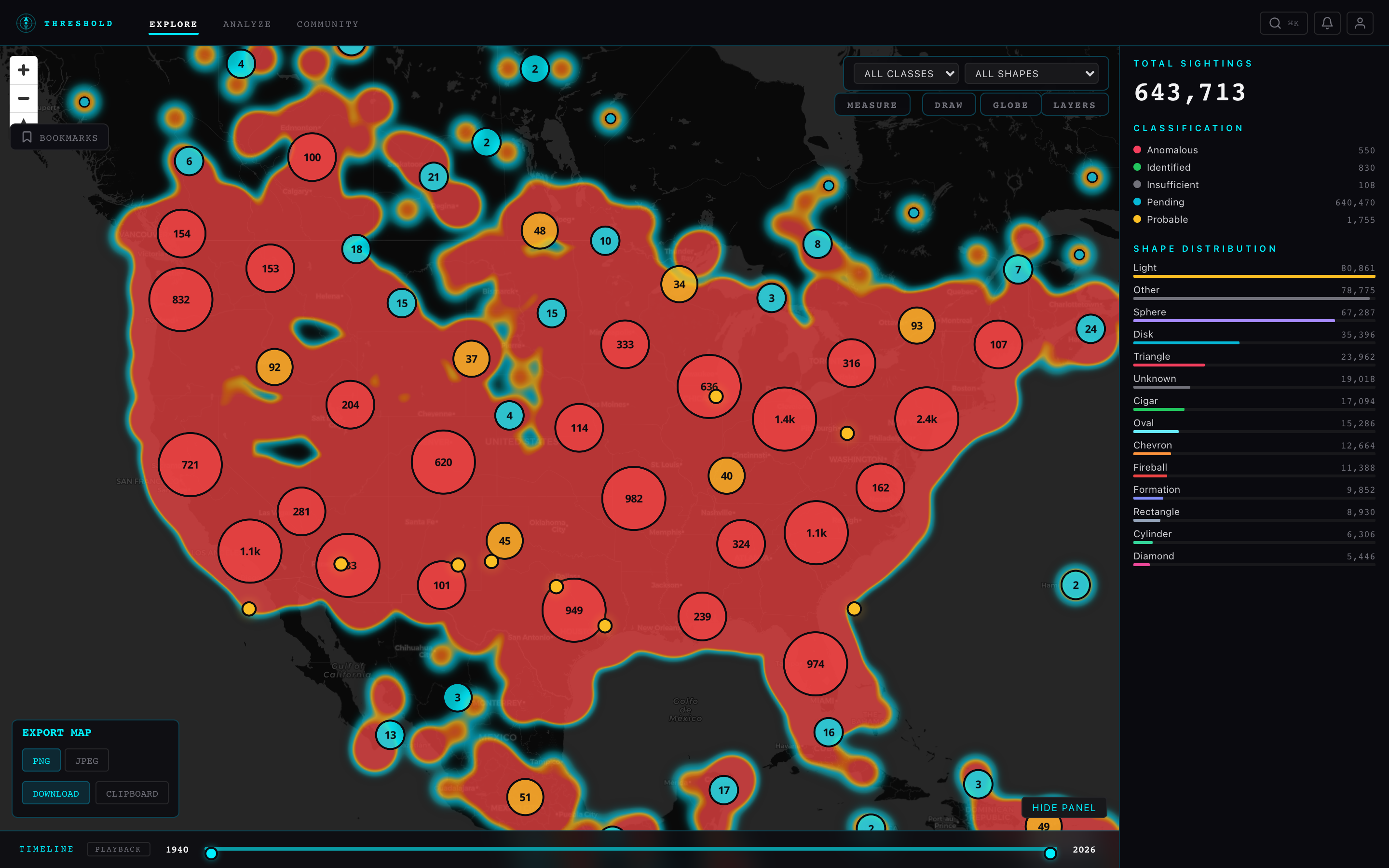
🗺
Intelligence Map
651,000+ sightings plotted with density heatmaps, clustering, temporal playback, and a dozen overlay layers—military airspace, nuclear facilities, fault lines, NOTAM zones, live aircraft and vessel tracking.
🐾
Cryptid Database
7,500+ cryptid sightings across 17 classified types: Bigfoot, Dogman, Mothman, lake monsters, sea serpents, Thunderbirds, Chupacabra, Crawlers, and more. Each type mapped with its own icon and color.
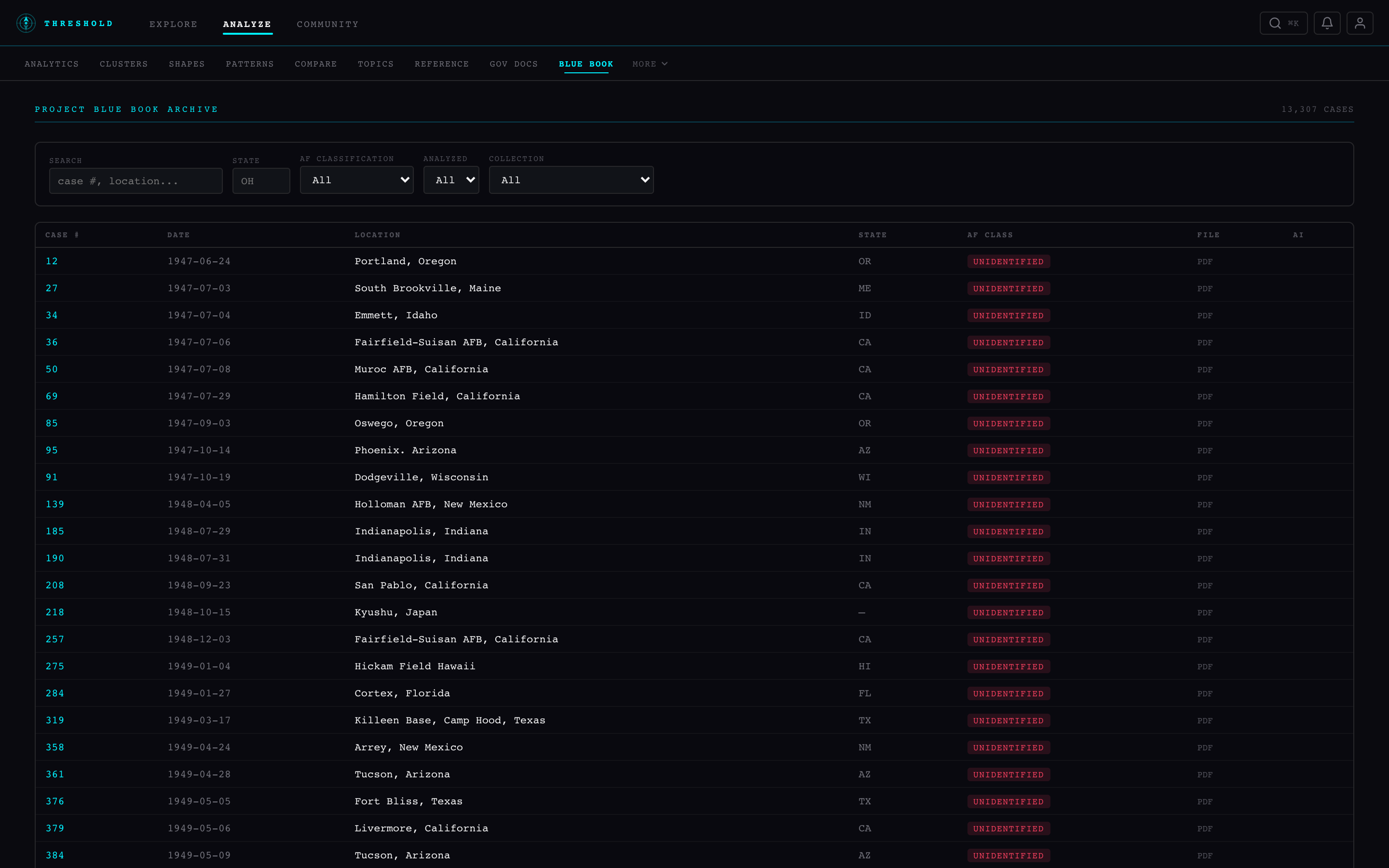
📜
Blue Book Archive
All 13,307 declassified Air Force cases from 1947–1969, digitized and searchable. AI-generated summaries alongside links to the original NARA documents.
📄
Government Document Vault
1,000+ FOIA releases from CIA, DIA, NSA, and allied agencies. Full-text search. Cross-referenced with sighting clusters from the same time and place.
🛰
Live Traffic Overlay
Real-time military and civilian aircraft from ADS-B, vessel tracks from AIS, and active NOTAM airspace restrictions—all layered on the same map as your sighting data.
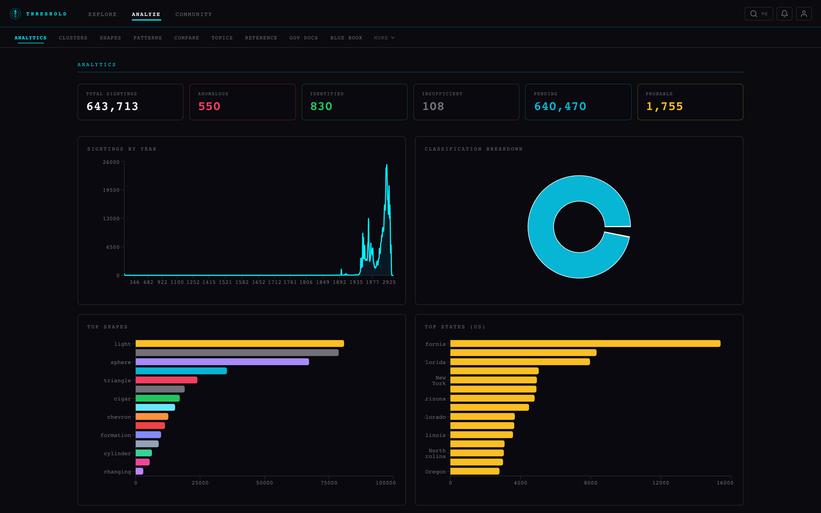
📊
Pattern Analysis
Temporal cycles, spatial autocorrelation, flap detection, shape-by-decade breakdowns, witness distribution curves. The math behind the sightings, not just the dots.
⚡
77 Live Connectors
New sightings flow in from NUFORC, MUFON, BFRO, Reddit, government press offices, space launch trackers, and international UAP agencies. The database grows while you sleep.